
Project Overview
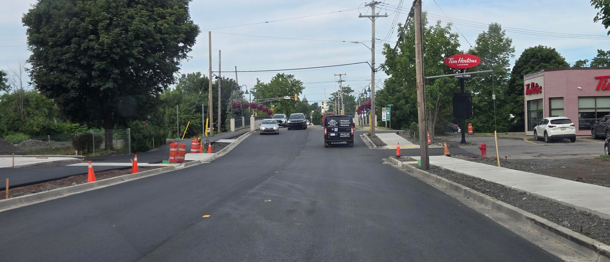
The Town of Antigonish is working to improve Main Street between Haley Road and Marian Drive. These improvements include a full sanitary main and watermain replacement within a new utility corridor, street recapitalization, and the continuation of active transportation network.
On this page
Project Highlight Video
Phase 1A
The tender for Phase 1 of the Bay Street Project was awarded to Dexter Construction for $2,182,315.00 + HST in the Fall of 2025.
From October to December 2025, construction was focused in the area between the bridge on the east end of Main Street (Haley Road) to the railway tracks.
- New water lines were installed from Haley Road to under the railway tracks and these new lines were connected to customers.
- New sewer lines were installed up to the railway tracks.
- The street between Haley Road and the tracks was raised for flood prevention.
- Prep work was done for new curb, sidewalks, and an active transportation trail.

Phase 1B
Mainly due to weather conditions (rain in November and multiple snowstorms in December), all the work for phase one was not completed as planned before the end of the year. The remaining work includes:
- Extending the new sewer line under the railway tracks
- New asphalt on the street and active transportation trail
- New concreate curbs and sidewalks
Project Updates:
July 24, 2026
Last asphalt is expected to be completed overnight early in the week of July 27.
July 17, 2026
This week included more concrete work and bringing potholes up to grade with the road level to prepare for asphalt.
June 18, 2026
This week saw extensive concrete work completed including sidewalk, aprons (driveways), and curbs to prepare for the top layer of asphalt in the coming weeks. At this time we are expecting work to continue overnight for the next week.

May 20, 2026
There were longer than usual delays on the Bay Street Project today due to a stalled vehicle in the construction zone that required towing. We know this created real frustration for people trying to get where they needed to be, and we’re sorry for the inconvenience it caused.As work continues over the coming weeks, there will be days when traffic is slow and getting around is harder than usual. These disruptions are never easy, and we understand the impact they have on daily routines.Crews moved quickly to clear the area and restore traffic flow as safely as possible. We are asking for people’s patience as we work to finish this project.
May 15, 2026
Crews were able to work this week with both lanes of traffic open. Crews were working on grading in preparation of the laying of concrete for the curbs and sidewalk.
Next week the work will require stop and go traffic on Wednesday, Thursday, and Friday from 7 a.m. to 6 p.m. For details: Public Notice: Bay Street - May 20 to 22, 2026
May 8, 2026
Work on the sewer line (the jack and bore) has been completed.
Crews will be shifting to day time work next week as we start the next phase of the project; installing the curbs and sidewalks. While this work will be done during the day, two-way traffic will be permitted with an altered centre line. We ask everyone traveling through the work area to be mindful of crews and equipment. This work will begin on Monday, May 11.
May 1, 2026
This week crews were working on the jack and bore and were successful in going under the railway tracks and breaking through to the other side. Work for this project is on schedule.
Next week they will be installing the sewer pipe and conducting water testing. This work will be done at night starting Sunday, May 3. For details: Public Notice for May 3 to May 8, 2026
April 24, 2026
Construction crews have wrapped up their first week back on the site since December. The work this week was focused on preparing the site and a pit for the jack and bore - instaling sewer pipes under the railway tracks. The work was done at night with traffic control being in place from 6 p.m. to 7 a.m. to minimize traffic disruption. Small adjustments were made this week to the traffic control plan after feedback from the community.
Work has been confirmed for next week as being night work. For details: Public Notice for April 26 to May 1, 2026
April 20, 2026
The Town's Electric Utility worked overnight and were able to successfully move power lines over to the new poles that were installed.
April 14, 2026
The Town's Electric Utility successfully installed new power poles to move lines. These new pole locatons will allow the street to be realigned.
April 10, 2026
An arborist was on site this week to remove some trees to make room for the street to be realigned. This will help with traffic control as construction will begin on April 20.
Phase Two
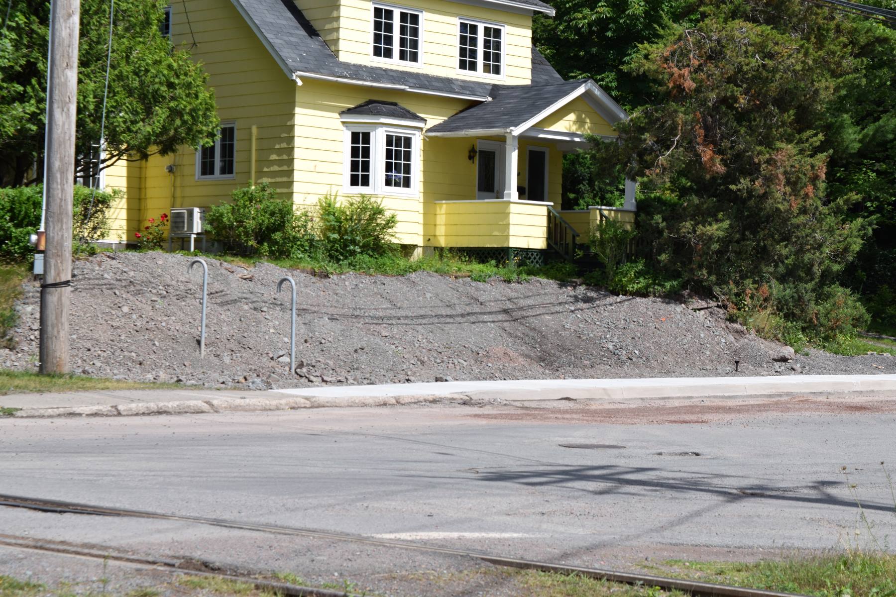
Phase two will pick up where phase one leaves off – at the railway tracks and continues up the hill to the hospital entrance at Marian Drive.
Similar to the first phase, new water and sewer lines will be installed, there will be the continuation of the active transportation trail with new curb and crosswalks. Phase two also include an updated rail crossing that will include a safer pedestrian crossing.
Once complete, this corridor will be re-aligned for a better street configuration and will create a connection to the existing multi-use pathway at Marian Drive.
A timeline for when phase two will be done has not been confirmed.
Funding Partners
The Town has secured a total of $3.476 million in approved funding from the Government of Canada, the Province of Nova Scotia, and the Municipality of the County of Antigonish. There are additional funding applications pending.

ICIP Funding - East Main to Adam Street - $466,199
Active Transporation Trail, curbs, railway crossing
ICIP Funding - Bay Street - $1,808,400
Water lines, sewer lines, and storm instrastructure
GRID Infrastructure Funding - $1,116,700
Road realignment, raising of the road, and moving utility poles
Municipality of the County of Antigonish - $117,000
Sewer instrastructure
Why is this work being done?
Repairing Infrastructure
The existing municipal services (water and sewar lines) in this corridor are over 100 years old and there was a failed sewer line near Haley Road. The infrastructure is in desperate need of repair and needs an upgrade to increase our capacity to better serve the surrounding community and accommodate future development.
Street Realignment
Bay Street will be realigned street layout for better traffic flow and safer sightlines. In phase one, the elevation of the street was raised to reduce the risk of flooding.
Accessibility
The current sidewalks going up the hill to the hospital entrance has utility poles in the middle of the sidewalk making them inaccessible. These poles will be moved outside of the walkway and the sidewalk will be transformed into a smooth, wider, active transportation trail.
None of the existing pedestrian ramps along Bay Street have tactile warning service indicators. These are a system of textured ground surface indicators to assist people who are visually impaired effectively navigate the environment and indicate where they are entering a traffic area.
Relocating Utility Poles
Several of the utility poles along the Bay Street corridor are located within the sidewalk, which is not convenient for pedestrians and particularly persons with disabilities.
Utility poles should be located off the roadway and sidewalk. These poles will be relocated to the grass boulevard between the roadway and the multi-use pathway for this project.
This Project Includes:
When all phases are complete, Bay Street and the east end of Main Street will have the following upgraded utilities:
- Installation of approximately 520m of new 300mm sanitary main
- Installation of approximately 550m of new 200mm watermain
- Installation of approximately 170m of new storm sewer
- Reconnection of existing services
- Relocation of utility poles
Full Street Recapitalization:
- Upgrades to existing road geometry
- 1200m of new curb
- 810m2 of new sidewalk
- 1450m2 of new active transportation facility
At Grade Rail Crossing Improvements:
- Improved geometry
- Designated pedestrian crossing infrastructure
Key Improvements:
- Replacement of over 100-year-old water pipes.
- Reconstruction of a failed sewer main near Tim Hortons.
- Realigned street layout for better traffic flow and safer sightlines.
- New accessible sidewalks and a multi-use Active Transporation trail connecting East Main, Adam Street, and the Hospital.
- Road raising near the river to reduce flood risk.
- Relocation of utility poles outside of walkways.
- Improved connections from the north and east to Downtown and the Landing trail.
